Difference between revisions of "Template:Infobox track/doc"
From LFS Manual
Jump to navigationJump to searchm |
(initial docs) |
||
| Line 1: | Line 1: | ||
<noinclude>{{documentation subpage}}</noinclude> | <noinclude>{{documentation subpage}}</noinclude> | ||
| + | '''Infobox track''' is used to create an infobox which summarizes the main information of a particular track environment. For well-built examples, see pages [[Blackwood]], [[Westhill]] and [[Rockingham]]. | ||
| + | |||
| + | == Usage == | ||
{{Infobox track | {{Infobox track | ||
| name = Track Name | | name = Track Name | ||
| Line 16: | Line 19: | ||
| weather_type2 = cloudy afternoon | | weather_type2 = cloudy afternoon | ||
| weather_type3 = overcast morning | | weather_type3 = overcast morning | ||
| + | | configurations = 3 | ||
| config1 = Configuration 1 | | config1 = Configuration 1 | ||
| Line 21: | Line 25: | ||
| turns1 = 6 | | turns1 = 6 | ||
| banking1 = 10° | | banking1 = 10° | ||
| − | | | + | | config1_surface1 = asphalt |
| − | | | + | | config1_surface_perc1 = 70 |
| − | | | + | | config1_surface2 = gravel |
| − | | | + | | config1_surface_perc2 = 20 |
| − | | | + | | config1_surface3 = tarmac |
| − | | | + | | config1_surface_perc3 = 10 |
| length_km1 = 3.45 | | length_km1 = 3.45 | ||
| + | | reverse1 = yes | ||
| grid_slots1 = 40 | | grid_slots1 = 40 | ||
| pit_speed_kmh1 = 80 | | pit_speed_kmh1 = 80 | ||
| config2 = Configuration 2 | | config2 = Configuration 2 | ||
| + | | config2_surface1 = grass | ||
| + | | config2_surface_perc1 = 100 | ||
| length_km2 = 1.00 | | length_km2 = 1.00 | ||
| reverse2 = yes | | reverse2 = yes | ||
| config3 = Configuration 3 | | config3 = Configuration 3 | ||
| area_km3 = 2.45 | | area_km3 = 2.45 | ||
| + | | reverse3 = no | ||
| + | }} | ||
| + | |||
| + | <pre> | ||
| + | {{Infobox track | ||
| + | | name = | ||
| + | | short_name = | ||
| + | | logo = | ||
| + | | logo_caption = | ||
| + | | track_map = | ||
| + | | track_map_caption = | ||
| + | | track_image = | ||
| + | | track_image_caption = | ||
| + | | type = | ||
| + | | license = | ||
| + | | introduced = | ||
| + | | weather_type1 = | ||
| + | | weather_type2 = | ||
| + | | weather_type3 = | ||
| + | | weather_type4 = | ||
| + | | configurations = | ||
| + | |||
| + | | config1 = | ||
| + | | direction1 = | ||
| + | | turns1 = | ||
| + | | banking1 = | ||
| + | | config1_surface1 = | ||
| + | | config1_surface_perc1 = | ||
| + | | config1_surface2 = | ||
| + | | config1_surface_perc2 = | ||
| + | | config1_surface3 = | ||
| + | | config1_surface_perc3 = | ||
| + | | length_km1 = | ||
| + | | grid_slots1 = | ||
| + | | pit_speed_kmh1 = | ||
| + | | reverse1 = | ||
| + | | area_km1 = | ||
}} | }} | ||
| + | </pre> | ||
| + | |||
| + | == Parameters == | ||
| + | {| class="wikitable" | ||
| + | |+ Infobox track parameters and basic guidelines | ||
| + | ! scope="col" | Parameter | ||
| + | ! scope="col" | Explanation | ||
| + | ! scope="col" | Example values | ||
| + | |- | ||
| + | ! scope="row" | name | ||
| + | | text | ||
| + | | {{code|...}} | ||
| + | |} | ||
{{-}} | {{-}} | ||
Revision as of 12:50, 24 January 2024
| This is a documentation subpage for Template:Infobox track.
It may contain usage information, categories and other content that is not part of the original page. |
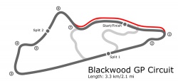
Infobox track is used to create an infobox which summarizes the main information of a particular track environment. For well-built examples, see pages Blackwood, Westhill and Rockingham.
Usage
| Track Name | |
|---|---|
 Track image caption |
|
 Logo caption |
|
 Track map caption |
|
| Short name | TR |
| Track type | permanent circuit |
| License | S1 |
| Introduced | 0.5P |
| Weather types |
clear day cloudy afternoon overcast morning |
| Configurations | 3 |
| Configuration 1 | |
| Short name | TR1 |
| Length | 3.45 km (2.144 mi) |
| Direction |
|
| Turns | 6 |
| Banking | 10° |
| Surface types |
asphalt (70%) gravel (20%) tarmac (10%) |
| Grid size | 40 |
| Reversed option |
|
| Configuration 2 | |
| Short name | TR2 |
| Length | 1.00 km (0.621 mi) |
| Surface types |
grass (100%) |
| Reversed option |
|
| Configuration 3 | |
| Short name | TR3 |
| Area | 2.45 km² (0.95 mi²) |
| Reversed option |
|
| LFS.net details | |
{{Infobox track
| name                =
| short_name          =
| logo                =
| logo_caption        =
| track_map           =
| track_map_caption   =
| track_image         =
| track_image_caption =
| type                =
| license             =
| introduced          =
| weather_type1       =
| weather_type2       =
| weather_type3       =
| weather_type4       =
| configurations      =

| config1            =
| direction1         =
| turns1             =
| banking1           =
| config1_surface1      =
| config1_surface_perc1 =
| config1_surface2      =
| config1_surface_perc2 =
| config1_surface3      =
| config1_surface_perc3 =
| length_km1         =
| grid_slots1        =
| pit_speed_kmh1     =
| reverse1           =
| area_km1           =
}}
Parameters
| Parameter | Explanation | Example values |
|---|---|---|
| name | text | ...
|